×

01.

Help Me With...

Select from list
My Residential Property
My Driver's License or Vehicle Registration
Requesting Assistance
Elections
Health Department

02.

Select from list
My Property Valuation
Understanding My Valuation
Paying My Property Tax
Neighborhood Sales
Building Permits
Vehicle Registration - New Stickers
Vehicle Registration - New Vehicle
Drivers License - New or Renew
New Resident Vehicle Registration
Adult Protection
Child Welfare
Child Support
Child Care
Financial Assistance
Medical Assistance
Food Assistance
Register to Vote / Update Voter Registration
Upcoming Election Information
Ballot Drop Box Locations
Voter Service and Polling Centers
Birth/Death Records
Restaurant Inspections
Community Health
Child Care Center Inspections
Septic System Inspections
Emergency Preparedness & Response
Disease Surveillance
Mental and Behavioral Health Education
Community Health and Clinical Services
Women, Infants and Children

03.

×
× Close

News

Who represents you? Check out Douglas County’s interactive map

District lines redrawn following 2020 Census

Posted on February 17, 2022 2022ElectionsNews and Events

Share

You are represented by elected officials at the local, county, state, and federal levels. Following the U.S. Census every 10 years, representation districts for these offices can change.

Visit Douglas County’s interactive map to enter your home address and view names of your County Commissioner, along with your representative for State House, State Senate, and U.S. Congress.

The Colorado Independent Congressional and Legislative Redistricting Commissions – established in Colorado’s Constitution in 2018 – draw Colorado’s congressional and state legislative districts. Nonpartisan commission staff processed and tabulated the 2020 Census data, incorporating geographic information, in-person and online public comments from commission hearings, and guidance from the commissions to create the new maps, which were approved by the Colorado Supreme Court in November 2021.

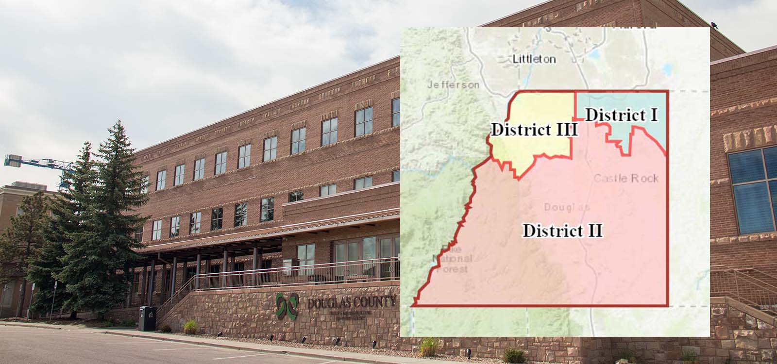
County Commissioners are also required to reassess their districts to ensure they are close to equal in population. Douglas County Commissioners approved the updated districts at a public hearing in September 2021.

Voter precincts are also adjusted as a result of the census data to ensure they are contained within the legislative and congressional lines and are less than 2,000 active registered voters. Those adjustments were approved by the Board of County Commissioners in January 2022.

Visit Douglas County’s interactive maps page to view Voter Precinct, County Commissioner, State House, State Senate and U.S. Congressional District maps. These maps take effect for Colorado’s 2022 congressional and state legislative elections.

Your County. Your News. Get it first.

Be among the first to receive news as it happens. Subscribe to our online news push, and select your specific news focus and delivery preferences. Visit the Live Town Hall page and register for Town Hall notifications to ensure you are contacted to participate in future community conversations about topics important to you. Both services are free, and you can unsubscribe at any time. And don’t forget to follow Douglas County on Nextdoor, Facebook, Twitter, Instagram, LinkedIn and YouTube.

Sign Up Now!