By order of Sheriff Darren Weekly, Stage 1 Fire Restrictions are in place for unincorporated areas of Douglas County. Ordinance No. O-012-004 restricts open fires, open burning and the use of fireworks in the unincorporated areas of Douglas County.
By order of Sheriff Darren Weekly, Stage 1 Fire Restrictions are in place for unincorporated areas of Douglas County. Ordinance No. O-012-004 restricts open fires, open burning and the use of fireworks in the unincorporated areas of Douglas County.
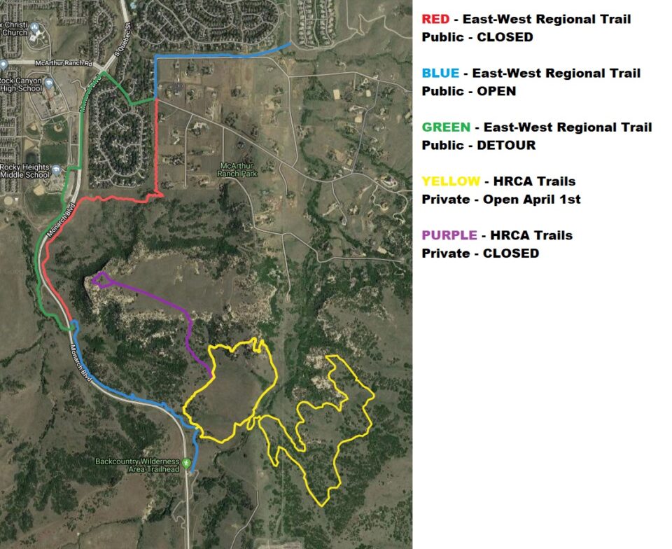
The East/West Regional Trail connects Highlands Ranch, Castle Pines, Lone Tree and Parker. The trail winds through grasslands and oak bluffs, including a thousand acres of the Highlands Ranch Backcountry. Trail connectors are located at Bluffs Regional Park, Highpoint Council Circle, Willow Creek Trail, RidgeGate Parkway, Schweiger Ranch, Rueter-Hess Reservoir, and the Cherry Creek Regional Trail.
Park and Trail Facilities are open for public use! To ensure availability for your event or if you have a group of 15 or more, please make a reservation!
Trail:
Amenities:
Hours:
Open one hour before sunrise or one hour after sunset.
Trail Detour Notice: Golden Eagle Breeding Season
Please be advised that an annual detour is in place on the East West Regional Trail due to the annual Golden Eagle breeding season. The affected section will be closed starting March and is expected to reopen on September 2nd.
Detour routes are shown on the map below, and signage with route details is posted on the trail to guide users safely around the closure.
We appreciate your cooperation in protecting this sensitive habitat and thank you for your understanding.